Extraordinary Erosion of the Genesis Flood
It is usually evident when an area has undergone a flood. Water has marked trees and buildings, debris has been moved, and so on. Obviously, the larger the flood, the more telltale signs. When creation science geologists discuss the Genesis Flood that happened a few thousand years ago, they point out amazing amounts of erosion all over the world.
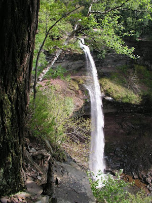
Up here in my neck of the woods near the Catskill Mountains, we have planation surfaces (large, flat areas on mountains) such as nearby Kaaterskill. There is also an escarpment (sharp incline) that covers three counties, and you can hike a good part of it. Planation surfaces, escarpments, and I may as well add those stand-alone lumps called inselbergs are baffling to uniformitarian geologists because there is no sign of them happening today. Lots of flood water is fast and powerful.
Then we have phenomenal erosion. When folks tell the cutesy version of the Noah's Ark story, they usually present a silly bathtub Ark and talk about forty days and nights of rain. Some even add that the fountains of the great deep opened up. But there is much more to it than that. Not only do we have catastrophic plate tectonics, but the Flood was in stages. The Recessive Stage caused phenomenal erosion (much of this was deposited in the continental margins). Creation science Flood geology models explain what is observed far better than deep time secular models.
 |
| From the New York State Education Department. Kaateskill. Internet. Available from http://www.nysm.nysed.gov/research-collections/geology/resources/kaaterskill; accessed May 2, 2010 (usage does not imply endorsement of site contents) |
Then we have phenomenal erosion. When folks tell the cutesy version of the Noah's Ark story, they usually present a silly bathtub Ark and talk about forty days and nights of rain. Some even add that the fountains of the great deep opened up. But there is much more to it than that. Not only do we have catastrophic plate tectonics, but the Flood was in stages. The Recessive Stage caused phenomenal erosion (much of this was deposited in the continental margins). Creation science Flood geology models explain what is observed far better than deep time secular models.
The Recessive Stage of the Flood was a time of intense continental erosion. The erosional debris formed the continental margin—a continuous wedge of mostly compacted sediments surrounding the continents. If we can determine which part of this wedge is composed primarily of detritus eroded during the Recessive Stage, some later cementing to sedimentary rock, then estimating the volume of those sediments and rocks could provide a rough quantitative estimate of material eroded from the continents. At present, a total value is not possible, but such an estimate can be made for select areas, providing a methodology that can be expanded to other marginal areas. One such area is the central Appalachian Mountains of the United States and its downgradient continental margin. Research shows an approximate average of 6,000 m of erosion across the Blue Ridge and Piedmont provinces. Another area is the continental margin off south-western Africa. Estimates there show an average 2,400 m of rock eroded off the adjacent continent. Erosion was probably greater in the coastal mountains and plains. Evidence from inselbergs on the coastal plain indicates that this erosional event was as rapid as it was significant. If representative, these studies show that much more sedimentary rocks and sediments existed on the continents than the present average of 1,800 m. Since a large proportion (about 30% or more) of the margin sedimentary rocks are Cenozoic, the Flood/post-Flood boundary must be in the late Cenozoic, assuming the geological column is an accurate chronostratigraphic representation of the rock record.Yes, it's rather technical. To read the rest, click on "Tremendous erosion of continents during the Recessive Stage of the Flood".